Wajir County, located in the northeastern part of Kenya, is a region known for its arid landscapes, pastoralist communities, and rich cultural heritage. Situated in the arid and semi-arid lands (ASAL) of Kenya, the county offers a unique blend of resilience, nomadic traditions, and the rugged beauty of the northeastern frontier. It is an inviting destination for those seeking to explore, study, work, invest, or reside in this dynamic and culturally diverse part of Kenya.
Unique Facts in Numbers
- Area: Wajir County covers approximately 55,840 square kilometers, offering a geographical landscape characterized by vast arid plains, riverine ecosystems, and nomadic pastoralism.
- Population: The county had an estimated population of over 781,000 people in 2019, creating a closely-knit and culturally diverse community.
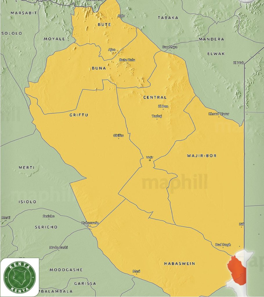
- Sub-Counties: Wajir County comprises six sub-counties, each contributing its unique attributes and contributions to the county’s development.
Geopolitical Facts
- Borders: The county shares its borders with neighboring countries, including Somalia and Ethiopia. It also borders Mandera and Garissa counties within Kenya. Its location places it in the northeastern region, near the international border.
Socio-Economic Activities
- Ethnic Diversity: The county hosts various ethnic communities, with the Somali people being the dominant group. Livestock keeping, trade, and nomadic pastoralism form the primary livelihood. Additionally, other communities like the Borana, Rendille, and Gabra engage in various activities, including livestock keeping and trade.
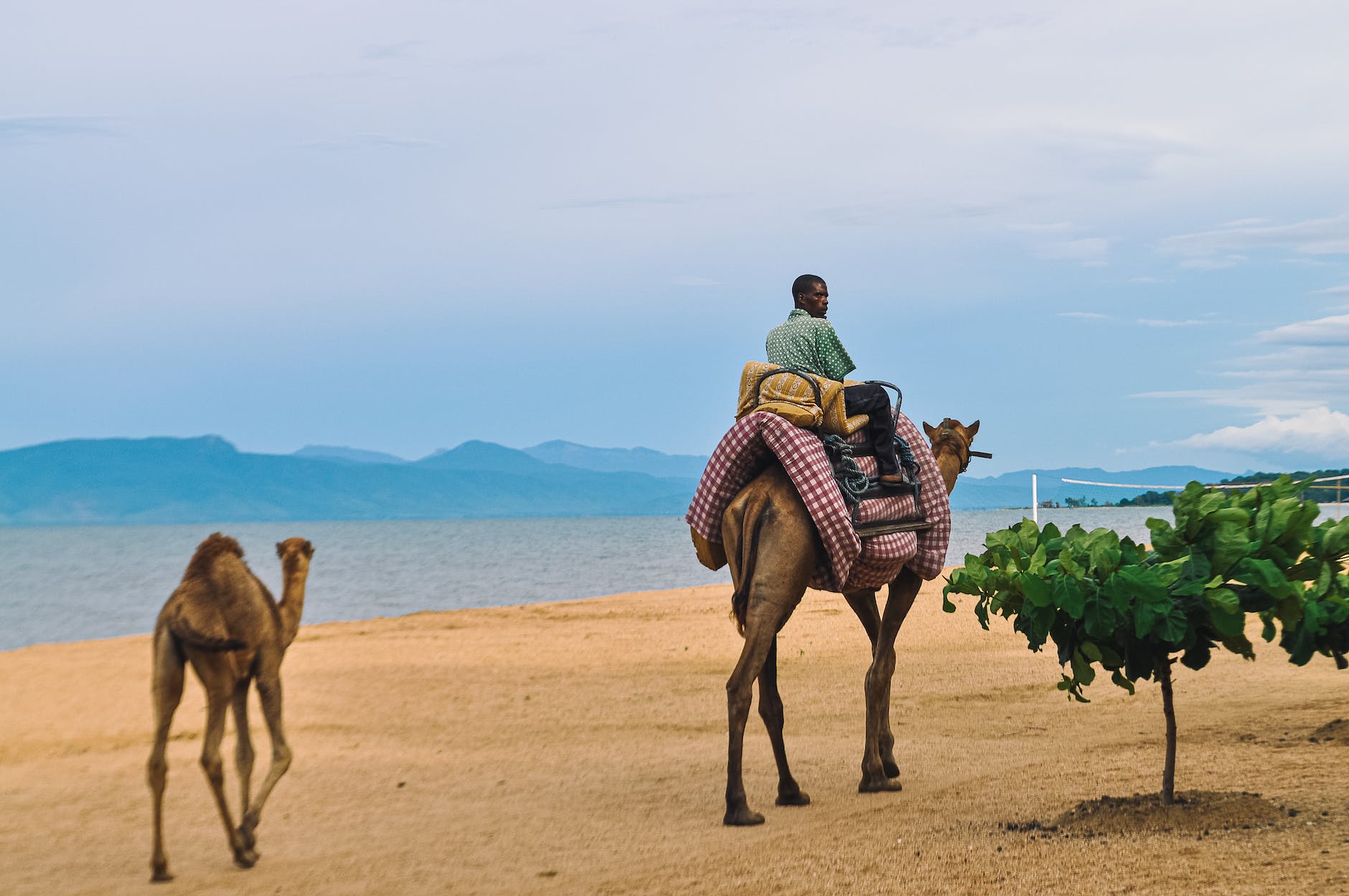
- Pastoralism: Wajir County’s economy is characterized by a strong focus on nomadic pastoralism, with livestock, particularly camels, goats, and sheep, forming the backbone of livelihoods.
- Cultural Heritage: The county is rich in cultural heritage, with traditional attire, songs, dances, and nomadic practices forming an essential part of its identity.
Natural Attractions
- Tana River: The county is traversed by the Tana River, which provides essential water sources for communities and potential opportunities for riverine ecosystems and irrigation.
- Riverine Ecosystems: The presence of rivers like the Tana River offers opportunities for wildlife, birdwatching, and unique ecosystems within an arid region.
- Geographical Features: Wajir County’s unique landscapes, including hills and plains, provide opportunities for geological exploration and cultural significance.
Challenges Hindering Development
- Wajir County faces various development challenges, including limited access to water resources, education, and healthcare services, as well as the impact of recurring droughts.
Economic Opportunities
- Pastoralism and Trade: The county’s economic potential is closely tied to nomadic pastoralism and cross-border trade, offering opportunities for growth, employment, and the preservation of traditional practices.
- Agriculture and Irrigation: Exploring sustainable agricultural practices, such as crop farming and irrigation, offers potential for enhancing food security and economic diversification in arid areas.
Wajir County is not only a land of arid plains but also a land of opportunities, resilience, and cultural diversity. Its dynamic communities, focus on nomadic pastoralism, and strong ties to cross-border trade contribute to a promising environment for growth and development, all while overcoming the challenges posed by arid conditions.
Comments are closed